The best things to do in Yosemite National Park are excellent for those looking for adventure in California. The vast area encompasses massive granite mountains, hundreds of majestic waterfalls, 1,600 miles of rushing streams, meadows, and 3 groves of giant sequoia trees.
It’s easy to feel humble in Yosemite Valley, especially when standing at the base of the 4,800-ft-high Half Dome or the 3,200-ft-high Glacier Point. You may find these views familiar, thanks to classic paintings by Thomas Ayres and iconic photographs by Ansel Adams. Experience the great Californian outdoors with our guide to Yosemite National Park’s most famous landmarks.
What are the best things to do in Yosemite National Park?
- 1
Yosemite Valley
Enjoy views of the park’s granite mountains

- Familier
- Billeder
Yosemite Valley is one of the most visited areas in Yosemite National Park. Most arrive by way of the El Portal Road, which runs alongside the Merced River. This offers your first glimpse of the towering granite monolith El Capitan, which stands about 3,000 ft tall.
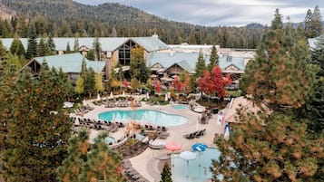
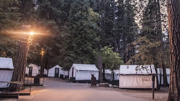
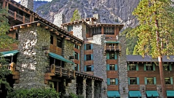
From the floor of Yosemite Valley, you can gaze up at the granite face of Half Dome or Sentinel Dome. This is also the starting point of a 3-mile roundtrip hike to Vernal Falls. Accommodation is available in the valley, ranging from tents and cabins to hotels with modern amenities.
Adresse: Yosemite Valley, CA 95389, USA
Kort - 2
El Capitan
A vertical rock formation popular for hiking

- Oplevelser
- Billeder
El Capitan is a notable landmark of Yosemite National Park. Magnificent by itself, or as the focal point of a wide-angle shot with nearby Cathedral Rocks, this 3,000-ft granite cliff attracts photographers with telephoto lenses to capture climbers in action. El Capitan is beautifully reflected in the Merced River as well.
The most popular view is from El Capitan Meadow, at the roadside where Northside Drive meets El Capitan Drive. You can park on either side of the road. Hikers can attempt to scale the summit via a 15-mile-long route. Your reward is expansive views of surrounding peaks like Taft Point, Dewey Point, Half Dome, and Clouds Rest.
Kort - 3
Vernal Falls
Hike the John Muir Trail for elevated views

- Oplevelser
- Billeder
Vernal Falls reach 317 ft in height and are accessible via a 3-mile trail to a footbridge of the same name. You can buy provisions at the Yosemite Village Store before taking the free Yosemite Valley Shuttle to the trailhead of the John Muir and Mist Trails. The hike is entirely uphill on the way to Vernal Falls, but you’ll be treated to elevated views of the waters cascading into the Merced River.
It's fairly strenuous, so most beginners are content to admire the view from the Vernal Falls Footbridge, located less than a mile along the trail. The more intrepid will follow the Mist Trail to the larger Nevada Falls. Vernal Falls is at its best is from late April to early May.
Adresse: Yosemite Valley, CA 95389, USA
Kort - 4
Hetch Hetchy
Explore waterfalls cascading onto a glacial valley

- Oplevelser
- Billeder
Hetch Hetchy occupies the northwestern area of Yosemite National Park, centring on a glacial valley carved by the Tuolumne River. Surrounded by granite cliffs and remote lakes, Wapama Falls is one of its most prominent features, which you can visit via a 5-mile roundtrip trail around a reservoir of the same name.
Hetch Hetchy is mostly frequented by backpackers but remains rather peaceful year-round – great for escaping Yosemite’s crowds. Hiking is very popular in spring and autumn, when many people come to tackle the trail to the 7,750-ft-tall Smith Peak, the area’s highest point.
Kort - 5
Tour Yosemite by road
Enjoy a road trip through mountains and meadows

Yosemite National Park has around 350 miles of roads winding through the mountains, offering broad vistas and, occasionally, white-knuckled thrills. The 46-mile Tioga Road from Crane Flat to Tioga Pass takes you through the High Country to Tuolumne Meadows. It’s open between late May and November, depending on road and weather conditions.
Other key destinations you can visit by road include Glacier Point, south of Yosemite Valley, Wawona and Mariposa Grove, at the southern end of the park. You can pick up a map at the Yosemite Conservancy Bookstore, located in the Yosemite Valley Visitor centre.
- 6
Glacier Point
An iconic viewpoint in Yosemite Valley

- Oplevelser
- Billeder
Glacier Point overlooks Yosemite Valley from 3,200 ft up, giving you expansive panoramas of Yosemite National Park's notable landmarks. You can hike to the viewpoint from the valley via the Four Mile Trail or Panorama Trail, which is 8.2 miles.
Alternatively, a bus tour will allow you to take in the High Sierra, including El Capitan, Bridalveil Fall, and Half Dome, as well as Yosemite Falls, Nevada Falls, and Vernal Falls – all within a 4-hour guided excursion. Tours usually leave the Yosemite Lodge at 8.30 am, 10 am, and 1.30 pm.
Adresse: Glacier Point Rd, Yosemite Valley, CA 95389, USA
Kort - 7
Yosemite Falls
The highest waterfall in North America

- Oplevelser
- Billeder
Yosemite Falls is a picturesque landmark and hiking spot in Yosemite National Park. With a height of over 2,425 ft, it’s the tallest waterfall in North America. Surrounded by the Sierra Nevada mountain range, it’s especially beautiful in late spring, with peak flow usually in May.
You can reach the top of Yosemite Falls via a 7.2-mile roundtrip trail, which takes about 8 hours of strenuous hiking. It’s a good idea to start your journey early as there’s little to no shade along the way. For an easier hike, you can tackle the 1-mile loop trail leading to the base of the Lower Yosemite Falls.
Adresse: Yosemite Village, CA 95389, USA
Kort - 8
Half Dome
Take on one of the most challenging hikes in Yosemite

- Oplevelser
- Billeder
Half Dome towers nearly 5,000 ft above Yosemite Valley, attracting seasoned mountaineers with its thrilling hiking route. The granite formation lies on the eastern end of the valley, featuring a distinct shape that inspired its name. It’s visible from several spots within the national park, including Glacier Point, Mirror Lake, and Olmsted Point.
Half Dome’s Cables Route is one of the most challenging expeditions in the park. The trail runs between 14 and 16 miles long, with up to 4,800 ft in elevation. After reaching its base, you’ll have to scale 400 ft using 2 steel cables without using any rock-climbing gear.
Kort - 9
Tuolumne Meadows
Spend a night surrounded by alpine grasslands and mountains

- Oplevelser
- Billeder
Tuolumne Meadows is at an elevation of 8,600 ft in the Sierra Nevada mountain range. Visit in spring when the grasslands are covered with thousands of blooming wildflowers, with excellent views of Yosemite’s waterfalls, valleys and granite cliffs.
Spending a couple of nights in the wilderness is possible thanks to the Tuolumne Meadows Campground in Yosemite National Park. Hikers can try the 4.8-mile roundtrip trail to Elizabeth Lake, a glacier-carved lake at the base of Unicorn Peak. There’s a shorter hike through Tuolumne Meadows to Soda Springs.
Kort - 10
Mariposa Grove
Hike past gigantic sequoia trees

- Familier
- Billeder
The Mariposa Grove is 1 of 3 groves in Yosemite that contain giant sequoia trees, most of which are thousands of years old. Located at the national park’s southern end, it has more than 500 mature giant sequoias. The oldest tree in the grove is named the Grizzly Giant, reaching almost 210 ft tall and estimated to be over 1,800 years old.
There are several hiking routes in Mariposa Grove, with the Big Trees Loop Trail being the most popular for families and beginners. The paved path takes about 30 to 45 minutes, passing giant sequoias with informative panels along the route.
Kort


